


DELMARVA - A relatively quiet stretch of winter weather will hold across Sussex County from late Thursday evening through late Friday evening, ahead of a fast-moving system expected to bring light snow Friday night, forecasters said.
Skies are expected to trend cloudier at times into Friday, with chilly conditions continuing. The better chance for snow in Sussex County holds off until late Friday evening, with snow becoming more likely Friday night. Accumulations in southern Delaware are expected to be minor — generally under an inch — while higher totals closer to an inch are more likely farther north and east in the region.
Dry air could limit how much snow reaches the ground Friday night, which is why snowfall confidence remains modest even as expected moisture has ticked up slightly.
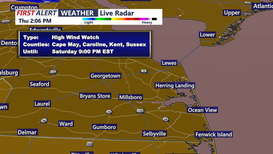
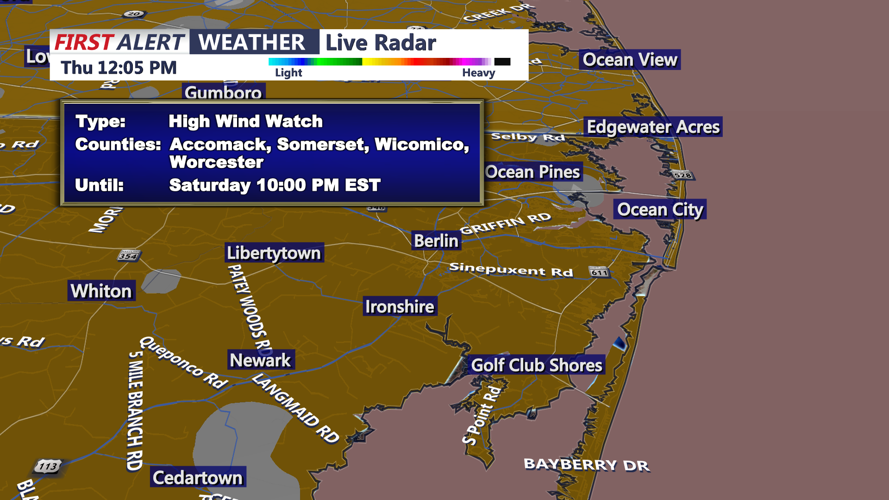
While the Friday forecast is comparatively mild, officials urged residents to keep an eye on the weekend, when an arctic front is expected to usher in sharply colder air and escalating winds as a strengthening storm develops off the coast. High winds could become a concern for parts of the Delmarva and nearby coastal areas later Saturday, and dangerously low wind chills are possible late Saturday into early Sunday under an extreme cold watch, the National Weather Service said. A storm watch has also been issued for some coastal waters.
