


DELMARVA - In the wake of a notable winter storm that deposited considerable snow across Sussex County, Delaware, and Ocean City, Maryland, residents should prepare for a transition to significant rainfall beginning Wednesday evening. This shift in weather patterns may result in rapid snowmelt, increasing the risk of localized flooding and challenging travel conditions.
Wednesday Morning
The early hours are expected to bring a brief period of light snow or a wintry mix, particularly in inland areas of Sussex County. Accumulations are anticipated to be minimal, generally ranging from 1 to 3 inches. Morning commuters should exercise caution, as roads may be slippery due to residual snow and ice. Temperatures are forecasted to rise into the mid-30s to low 40s by late morning, aiding in the gradual melting of existing snow.
Wednesday Afternoon
A temporary lull in precipitation is expected during the afternoon hours. Overcast skies will persist, with temperatures continuing to climb, reaching highs between 42°F (5°C) and 45°F (7°C). This warming trend will contribute to further snowmelt, increasing moisture levels in the environment.
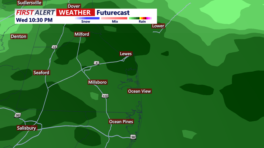
Wednesday Evening
By late afternoon into the evening, a developing low-pressure system approaching from the Ohio Valley is projected to bring substantial rainfall to the region. Forecasts indicate that areas southeast of the I-95 corridor, including Sussex County and Ocean City, will primarily experience rain due to the warmer temperatures. The combination of rain and melting snow could lead to significant runoff.
Potential Impacts
Flooding: The influx of rain atop the existing snowpack may result in rapid snowmelt, elevating the risk of localized flooding in low-lying and poorly drained areas. Residents are advised to monitor local waterways and be prepared for potential flood conditions.
Travel Conditions: While the transition to rain will help clear roadways of snow and ice, the initial onset may create slick surfaces. Motorists should remain vigilant, particularly during the evening commute, and be aware of possible water accumulation on roads.
Precautionary Measures
Stay Informed: Regularly check updates from the National Weather Service and local authorities for the latest forecasts and advisories.
Prepare for Flooding: If residing in flood-prone areas, ensure that drainage systems are clear and consider relocating valuable items from basements or lower levels.
Exercise Caution While Traveling: Allow extra travel time, reduce speeds, and maintain a safe distance from other vehicles. Be particularly cautious in areas prone to flooding or where water is pooling on roadways.
As weather conditions evolve, staying informed and taking proactive steps can help mitigate the potential impacts of the anticipated rainfall following the recent snowfall.
