


DELMARVA - High pressure will briefly settle over the region Friday night, bringing dry and cold conditions. Overnight lows will fall into the teens and 20s under mostly clear skies. However, by early Saturday, a strengthening low-pressure system over the mid-Mississippi Valley will begin spreading precipitation into the region, setting the stage for a messy weekend.
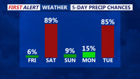
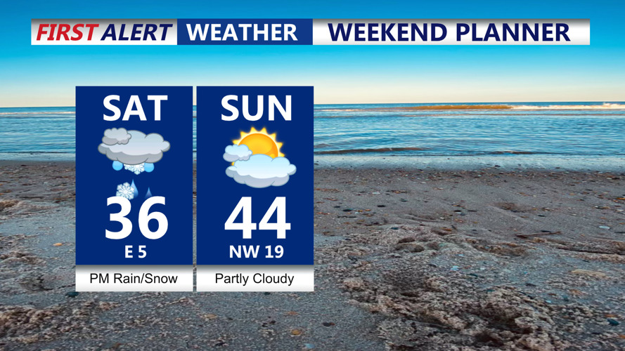
Light snow and freezing rain are expected to develop Saturday morning across southern areas, gradually expanding northward through the afternoon. As temperatures rise, locations along the coast, including much of southern New Jersey and Delmarva, will likely see a transition to plain rain. Meanwhile, areas northwest of the I-95 corridor will experience a prolonged period of wintry mix, including snow, sleet, and freezing rain, before precipitation tapers off late Saturday night into early Sunday morning.
The system is expected to bring snowfall totals similar to the previous storm, but with a greater mix of wintry precipitation across northern and inland areas. The highest snowfall amounts will likely occur in the southern Poconos and northwestern New Jersey.
By early Sunday, precipitation will end as the low-pressure system moves offshore. Sunday afternoon will be mostly dry, with a mix of sun and clouds and seasonable temperatures. High pressure will briefly return before another round of active weather is expected next week, with the potential for additional storm systems on Tuesday into Wednesday and again on Thursday.
