


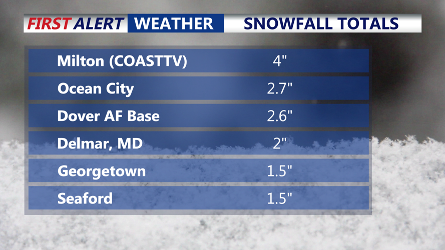


DELMARVA - Snow has accumulated quite quickly on the peninsula this morning. Powdery snow, temperatures in the teens for the western portion of the peninsula, 20s and 30s closer to the coast. 2 to 4 inches of snow is already on the ground for most of the area.
Winter storm warning remains active for the region, and the storm will deliver a combination of accumulating snow and ice with changing precipitation types throughout the day Sunday before arctic air returns and refreezing becomes a major concern.

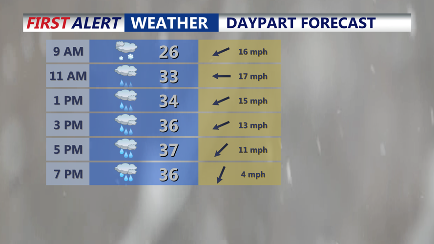
Expect a cold heavy rain this afternoon through the early evening. Temperatures rising above the freezing mark.
The worst travel conditions are expected this morning into early afternoon period, when bands of heavier snow may produce snowfall rates of 1 to 2 inches per hour. Those bursts can cause rapid accumulation and significantly reduced visibility, making driving dangerous even for experienced winter drivers.
Snow expectations remain 3 to 6 inches for central Sussex and the southeast corner of the county, where mixing is expected to develop sooner. For the rest of Sussex County, including areas closer to U.S. 13 and much of the inland peninsula, totals are expected to reach 5-7 inches, with a higher risk that sleet and freezing rain will add an icy layer on top of the snow. Could see an excessive of a quarter inch of ice on top of the snow from the Mid-Shore on points north.

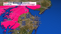
FUTURE ICE
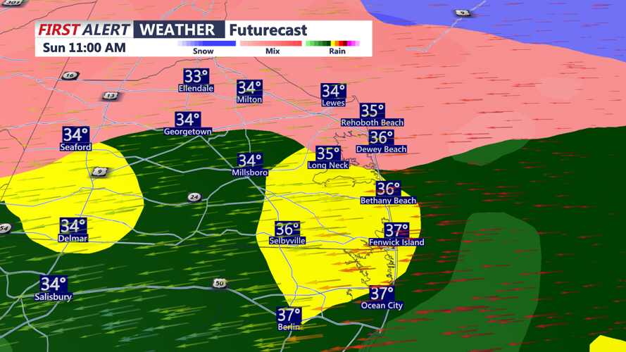
By late morning into Sunday afternoon, conditions will begin changing as warmer air pushes in above the surface. Snow is expected to become wetter and heavier before switching over to sleet, then freezing rain in parts of the county. Some locations closer to the coast may briefly change to plain rain if surface temperatures rise above freezing, but colder areas inland are more likely to stay in a mix longer.

Warm air filters in late morning through midday changing snow to sleet, freezing rain and eventually all rain.
The difference between those outcomes will be critical: sleet can pile up quickly and be difficult to clear, while freezing rain can glaze roads, power lines and trees. Even small ice accumulations can make roads nearly impassable and increase the chance of scattered power outages.
Conditions are expected to gradually taper Sunday evening, though patches of drizzle — including freezing drizzle — may linger into the night. A low-confidence period of light snow is also possible late Sunday night into early Monday.
From Monday morning into Monday afternoon, the primary hazard will shift from falling precipitation to lingering ice and refreezing. Temperatures are expected to remain at or below freezing, and any slush or standing water left behind from the afternoon mix Sunday could freeze solid, creating slick spots on roads and walkways even after the storm winds down.
Residents are urged to take precautions throughout the storm, including staying off the roads if possible, charging phones and devices ahead of any outages, and keeping flashlights and extra blankets accessible. Drivers who must travel should slow down, increase following distance and keep an emergency kit in their vehicle with water, snacks and gloves.

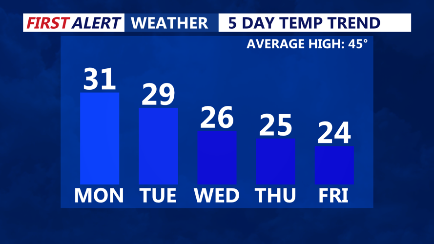
Temperatures staying below the freezing mark through all of next week.
Expect a bitterly cold and dry week ahead, temperatures won't get above the freezing mark through all of next week. Daytime highs in the teens and twenties, single digit overnight lows and subzero wind chills.
Stay up to date on the approaching winter storm with radar and hourly forecasts in the CoastTV weather app, available for Apple and Android.
