


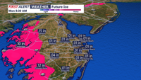
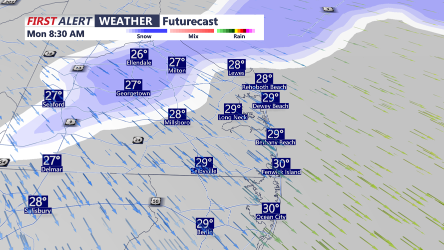


DELMARVA - After the weekend winter storm,temperatures are expected to remain below freezing through the start of next weekend, limiting melting and allowing icy patches to persist on roads and sidewalks.
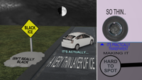
Early Monday morning, drivers may encounter hard-packed slush and black ice, especially on untreated back roads, bridges and overpasses. Forecasters have warned that even as precipitation tapers off, any moisture left behind can freeze quickly as temperatures drop into the teens and 20s.
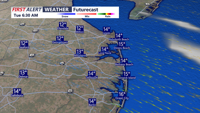
Conditions are expected to stay cold through Monday night, with another push of very cold air anticipated late Monday night into Tuesday morning. Forecasters said the returning arctic air will help keep highs mostly in the teens and 20s, while overnight lows fall into the single digits in some spots.
Windy weather will add to the cold, with gusts up to 30 to 35 mph possible at times. Wind chills are expected to run in the single digits to teens during the day, with overnight wind chills dropping closer to zero or below.
A cold front is projected to move through late Tuesday into early Wednesday morning, reinforcing the cold air already in place. We urge you to use caution on area roadways through the midweek commute, as icy conditions may redevelop overnight even if roads appear improved during the daytime.
