


DELMARVA -- A potent coastal storm continues to bring impacts to the region Monday, with the highest effects expected along the shoreline. The system, which has been churning offshore, will continue to deliver breezy conditions, spotty showers, and widespread coastal flooding through the day before conditions begin to ease.
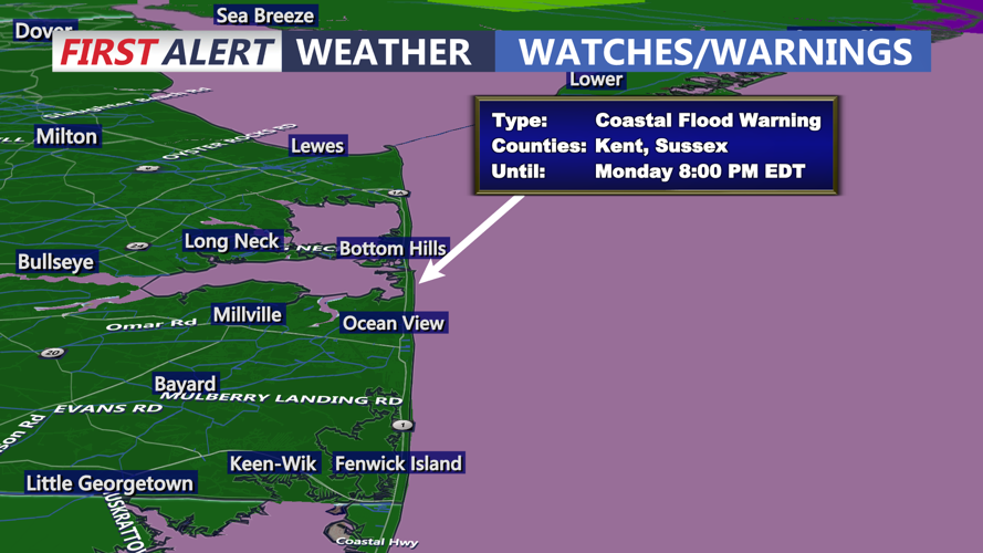
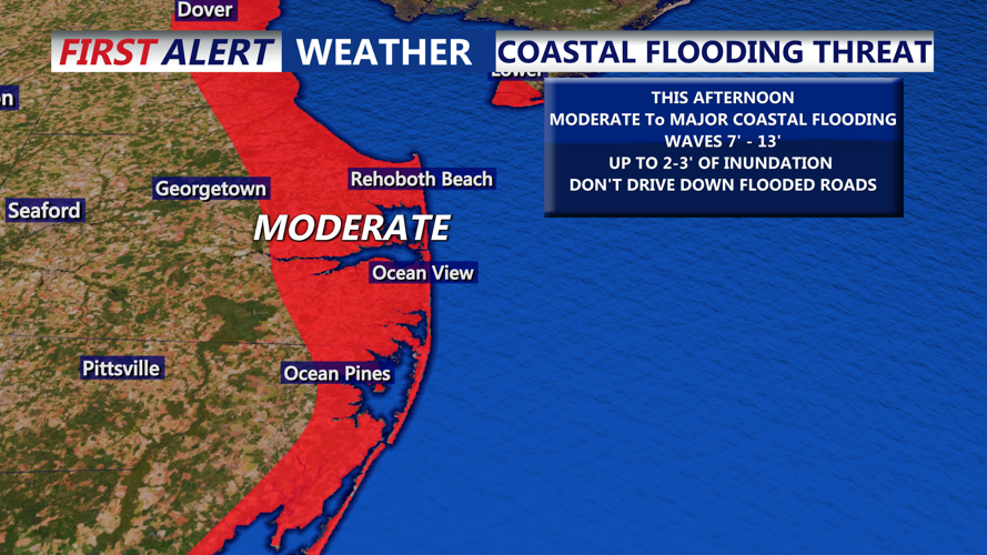
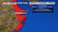
The primary concern for communities along the coast remains flooding, with moderate to major coastal inundation expected through high tide Monday afternoon. Water levels could rise between 1 and 3 feet in vulnerable areas, leading to flooding of roadways, low-lying property, and some coastal infrastructure.

MODERATE to MAJOR coastal flooding through this afternoons high tide cycle.
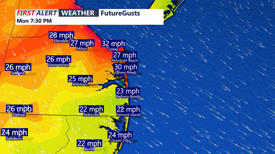
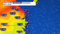
Winds will remain a factor as well, with gusts between 30 and 35 mph likely, especially near the beaches and bays.

The highest winds are behind us, but breezy gusts 3o to 35 MPH.
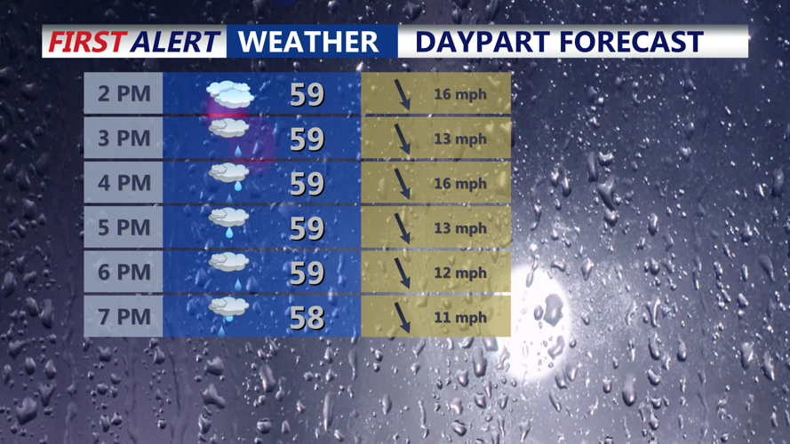
Occasional drizzle and showers will linger into the evening, though widespread rainfall is not expected. Temperatures will stay mild, hovering in the mid to upper 60s during the day and dipping only slightly into the mid to upper 50s overnight.

On and off showers, wrap around moisture, highs in the low 60s.
By Tuesday, the storm will slowly weaken and drift eastward, allowing weather conditions to steadily improve. While gusty winds may persist, especially near the coast, the chance of rain will taper off and clouds will remain with late clearing. High temperatures will again reach the upper 60s.
Clouds will continue to diminish Tuesday night as the storm moves farther out to sea. Winds will remain brisk, preventing significant fog formation, with overnight lows in the low to mid-50s.
Wednesday is shaping up to be one of the nicest days of the week, with mostly sunny skies and temperatures climbing into the upper 60s and possibly low 70s ahead of a cold front. Northwest winds will increase as the front passes, ushering in a noticeable temperature drop by nightfall, when lows will dip into the upper 30s to mid-40s.
The coldest air mass of the season so far will settle over Delmarva on Thursday and Friday as Canadian high pressure builds into the region. Daytime highs will likely struggle to reach 60 degrees Thursday, with slightly milder conditions Friday. Frost concerns remain uncertain, but temperatures are expected to fall into the 30s under clear skies.
A warm front will lift through the region Saturday, pushing temperatures back toward 70 degrees. Clouds will increase ahead of the next frontal system, which is expected to bring a renewed chance of showers Saturday night into Sunday. Despite the unsettled weather, warmer air will return, with highs reaching the low to mid-70s to end the weekend.
Don't forget to download the COAST TV Weather App: